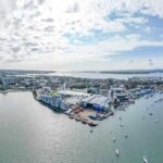
Current Project
Hengistbury Head Long Groyne works 2021-2024
As part of a 17-year Beach Management Scheme, the Long Groyne is being repaired & upgraded between April – October 2024
Lead Authority
BCP Council
Working with
Project start date
22 November 2021
Completion anticipated
Early October 2024
Last Updated
20 September 2024

The Long Groyne project is nearing completion
What’s happening now?
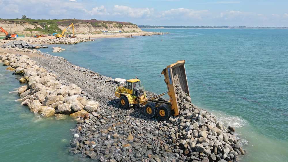
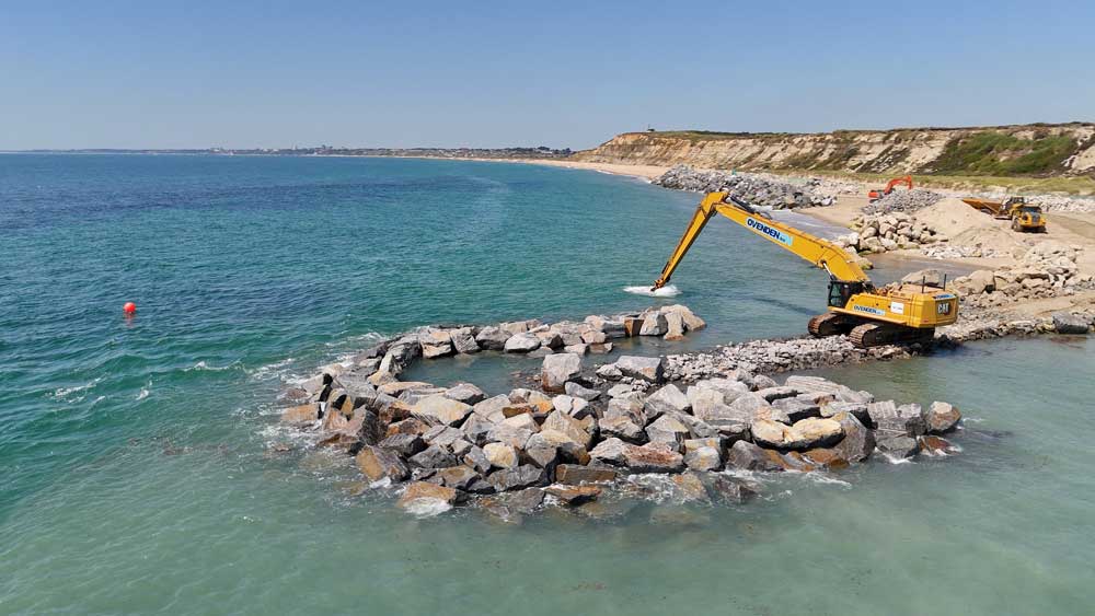
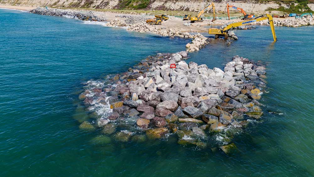
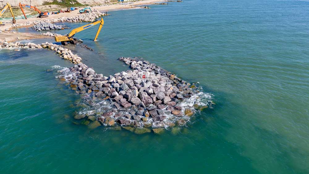
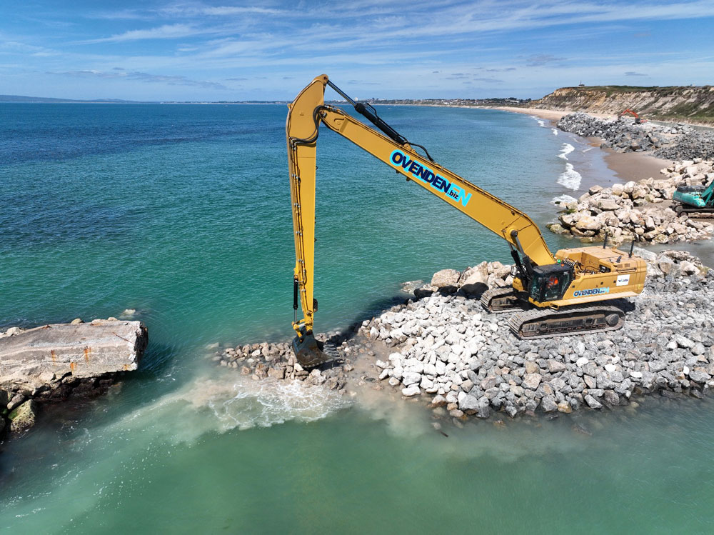
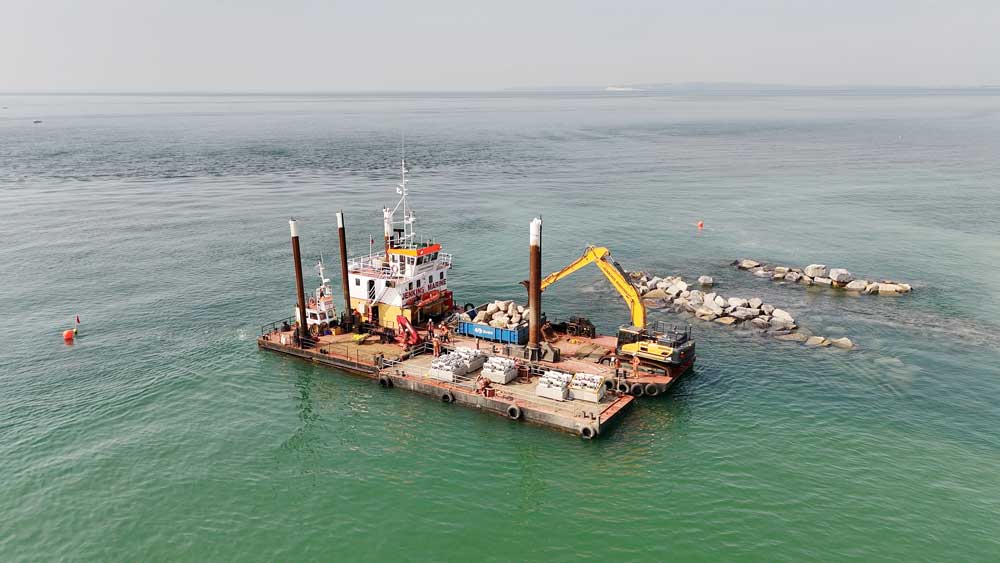
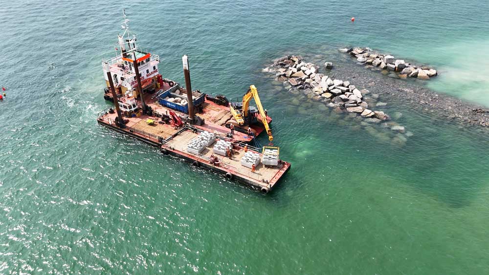
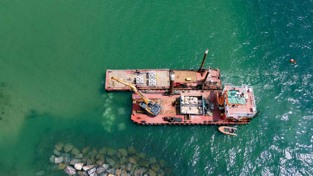
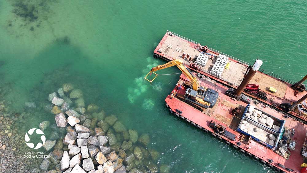
The upgrade of the Long Groyne is nearing completion. Our contractors have worked with the tides around the clock, placing a total of 33,500 tonnes of rock that arrived by sea from France and Norway. A host of environmental enhancements have been incorporated into the design to provide important new marine habitat.
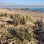
Access to the beach remains open. For your safety, please follow signage and keep your distance from large plant & machinery operating in the area. Dogs should be kept on leads. Marked pedestrian routes help you avoid walking across the environmentally protected Sand Dunes.
Local Notice to Mariners No. 10/2024 (pdf) was issued in March on behalf of BCP Council by Poole Harbour Commissioners.
Project Overview
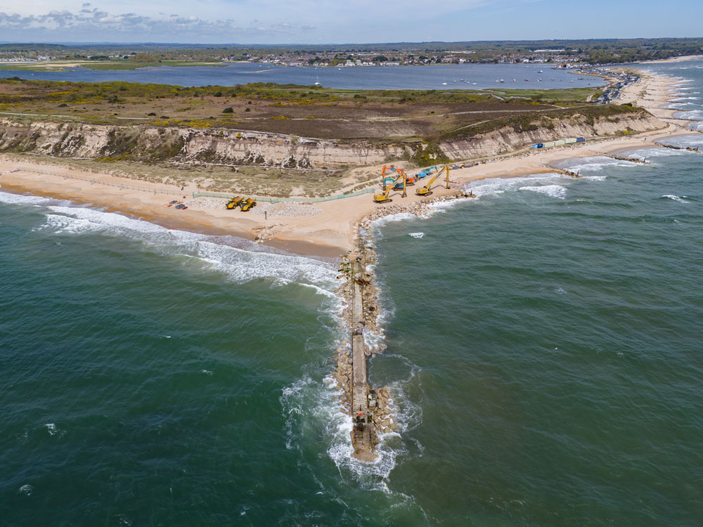
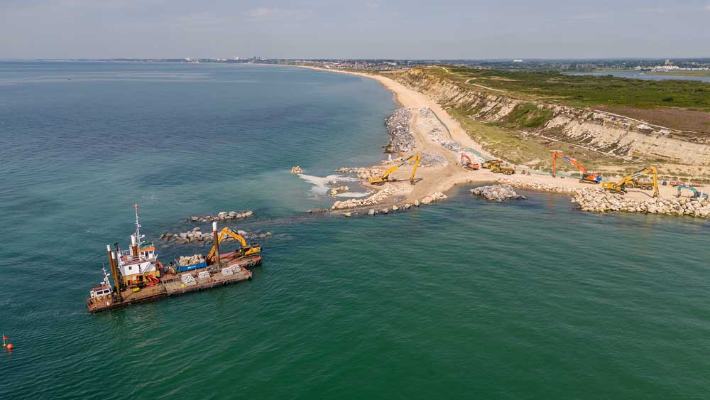
The long groyne at Hengistbury Head plays a critical role in reducing coastal erosion in Poole Bay and is a stabilising feature for Christchurch Bay. However, during storm events it is regularly submerged and its current condition means it is unable to continue to perform effectively, particularly with the additional threat of sea level rise.
A detailed inspection of the structure in 2019 revealed the groyne to be in very poor condition. Subsequent ground investigations and underwater surveys through 2021 & 2022 helped us prepare for the significant works required to protect the coastline from sea level rise over the next 100 years.

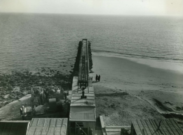
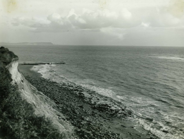
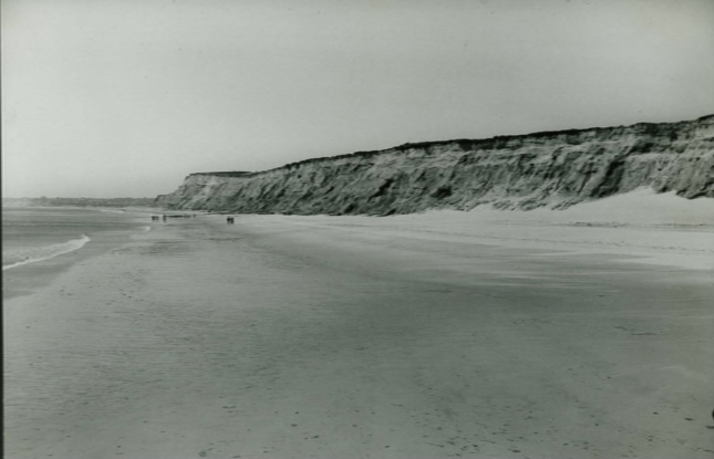
The works area at Hengistbury Head
Long Groyne project – the story so far
Our video describes a brief history of the Long Groyne and explains project progress from set-up of the working area in April to placement of the marine habitat units alongside the new groyne in late August.
It was compiled for an audience of visitors to our beachside exhibit during the Bournemouth Air Festival, 29-31 August 2024.
The full ‘Hengistbury Head’ episode aired 14 July and is available at BBC iPlayer
Countryfile at Hengistbury Head, July 2024
Sean Fletcher from BBC Countryfile meets Matt Hosey, Head of Service at South West Flood & Coastal and the team reconstructing the Long Groyne at Hengistbury Head to find out how BCP are defending the coast from flooding and erosion.
Sean jumps into a giant dumper truck and drives out to the groyne with Site Manager Maz Tamimi, then joins Dr Alice Hall, Marine Biologist, on the beach to learn how marine life will be offered new, artificial reefs to colonise around the new groyne.
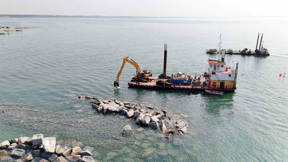
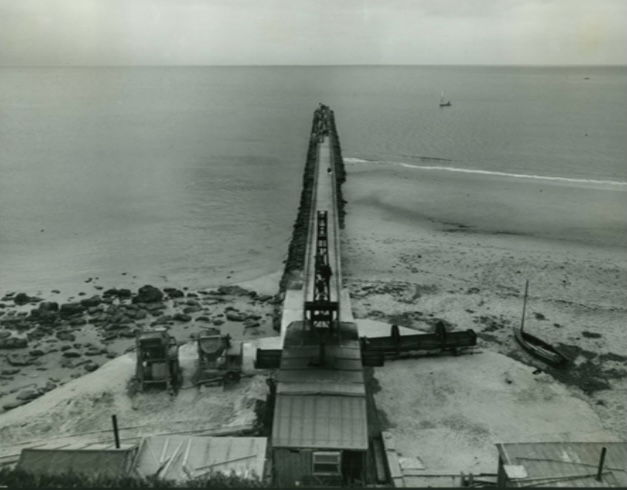
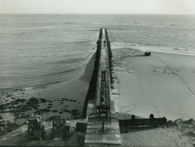
Project update 28 August
Filter layer installation
Large rock emplacement
Profiling filter layer for rock armou
Roundhead Construction
Roundhead Construction
Deconstructing the original groyne
July 2024
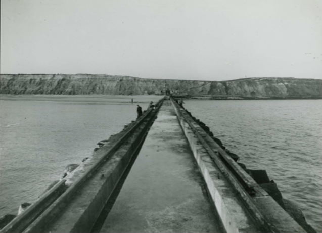
The original concrete long groyne at Hengistbury Head
The original concrete long groyne at Hengistbury Head

The old groyne is dismantled in sections
The old groyne is dismantled in sections
The concrete material is crushed to form the core of the new long groyne
The concrete material is crushed to form the core of the new long groyne

Demolition of the original groyne is now complete
Demolition of the original groyne is now complete
Project Overview
The long groyne at Hengistbury Head plays a critical role in reducing coastal erosion in Poole Bay and is a stabilising feature for Christchurch Bay. However, during storm events it is regularly submerged and its current condition means it is unable to continue to perform effectively, particularly with the additional threat of sea level rise.
A detailed inspection of the structure in 2019 revealed the groyne to be in very poor condition. Subsequent ground investigations and underwater surveys through 2021 & 2022 helped us prepare for the significant works required to protect the coastline from sea level rise over the next 100 years.
Construction
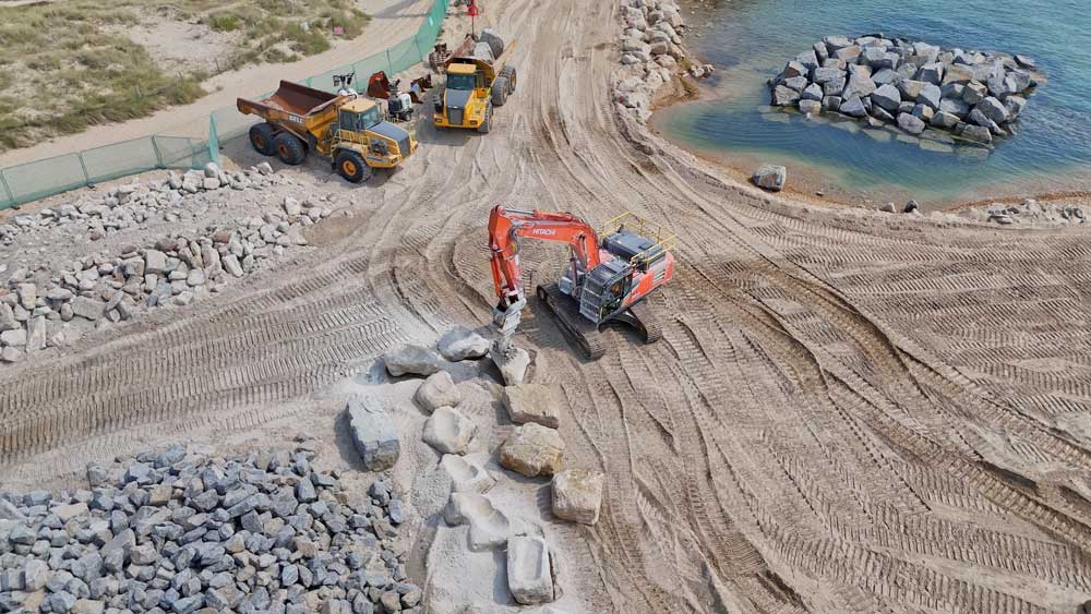
- Work to dismantle the original concrete groyne was carried out in short sections at a time to ensure beach material remained in place
- Concrete from the original structure, along with the old rock armour, has been used to form a new core base
- New rock armour is placed on top in the same footprint as the existing groyne.

Cross section of the upgraded design
The upgraded long groyne design:
- Maintains the same alignment and length as the original groyne (approximately 150 metres).
- Will be 1.5 metres taller along its crest than the original groyne to allow for increased storm events and predicted sea level rise.
- Will be wider than the original groyne to provide additional stability in this exposed location.
- Will be covered entirely in rock, using a natural quarry stone (armour) from France & Norway, chosen for its durability.
- Will use larger rocks (6 – 10 tonnes) than the original, to cope with the exposed location of the structure and the expected wave conditions.
- Re-uses material from the original structure wherever possible to avoid having to send material to landfill, and to minimise the amount to new rock required.
- Floating groyne markers have been placed at the sea end to aid navigation.
Project aims are explained by Richard Slee, ITV News
Video courtesy ITV News Meridian, 23 May 2024
Why the works are needed
If we did nothing to repair or upgrade the long groyne, then;
- The rate of erosion would rapidly increase at Hengistbury Head, resulting in the loss of beach followed by erosion of the cliffs;
- The long-term loss of land would extend across Purbeck, Bournemouth, Christchurch, Poole and the New Forest, including damage to infrastructure and thousands of properties;
- Mudeford Sandbank could be breached, creating further inlets to Christchurch Harbour;
- Both Poole Bay and Christchurch Bay would weaken and eventually become one bay.
Environmental enhancements
Hengistbury Head is a Scheduled Monument and site of international archaeological importance • a Site of Special Scientific Interest (SSSI) • Local Nature Reserve (LNR) • Special Area of Conservation (SAC) • Environmentally Sensitive Area (ESA) • Site of Nature Conservation Interest (SNCI) • Special Protection Area (SPA) and a Ramsar site.
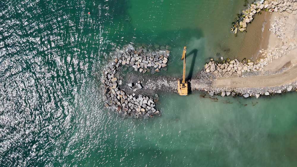
We are improving the marine habitat by incorporating a number of specially designed structures:
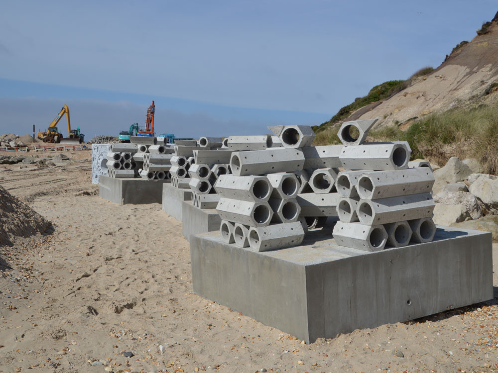
ReefSystems units designed for the Long Groyne
ReefSystems units designed for the Long Groyne
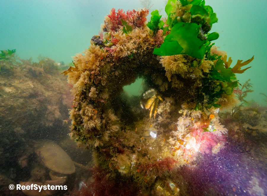
ReefSystems unit, example after colonisation by marine life
ReefSystems unit, example after colonisation by marine life
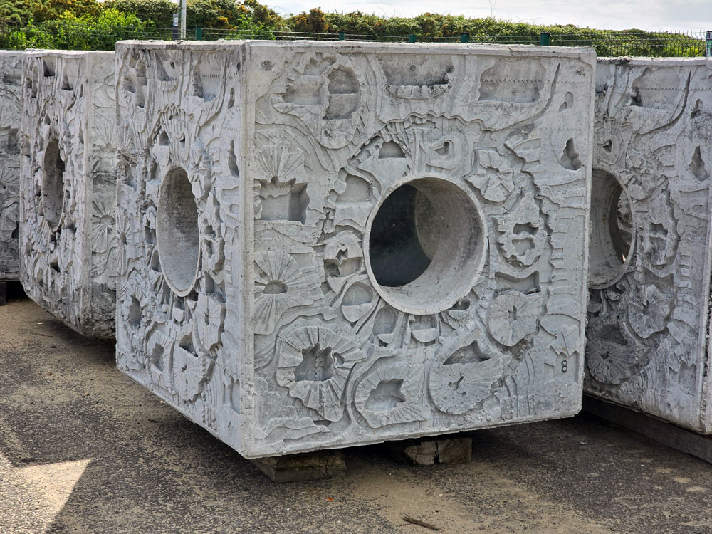
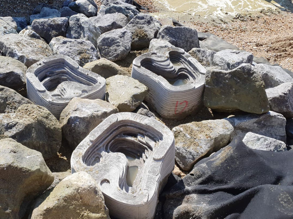
ARC Marine’s Intertidal reef cubes offer coastal defence in a design that provides a variety of marine habitat
ARC Marine’s Intertidal reef cubes offer coastal defence in a design that provides a variety of marine habitat
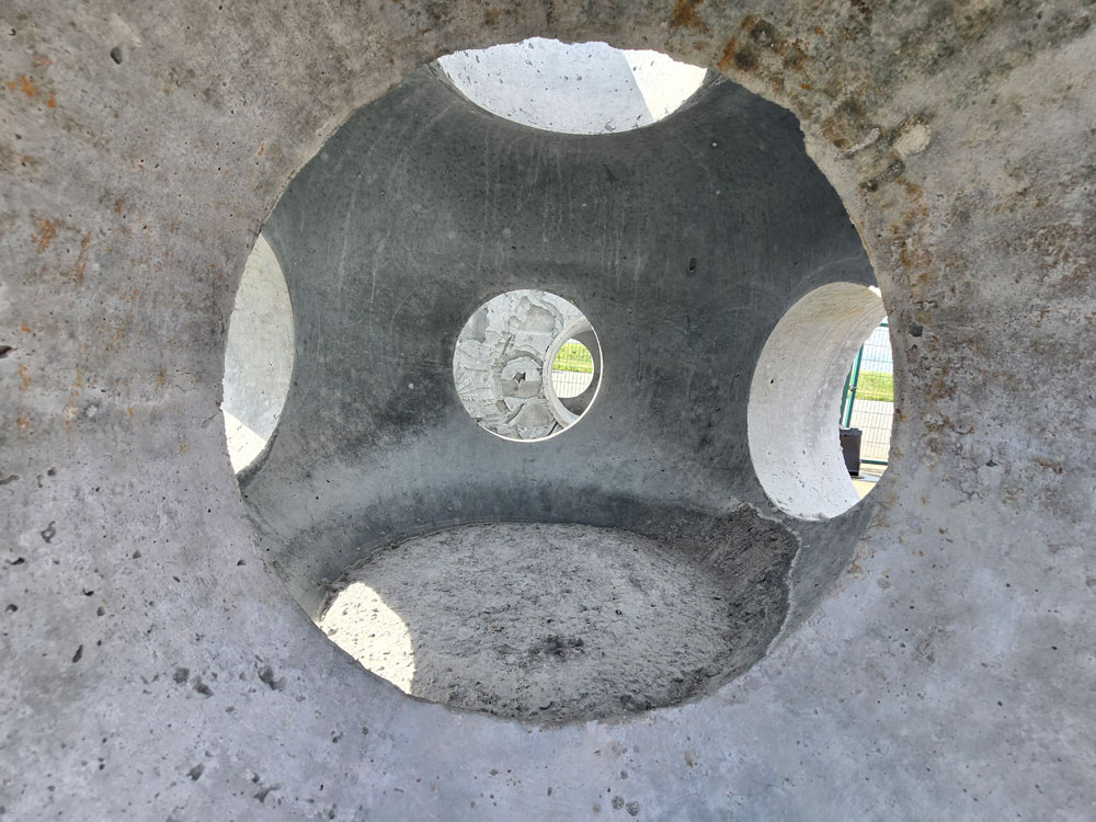
Internal design of the cubes
Internal design of the cubes
Tide pools
We will be creating & installing tide pools on site using old rock armour to mimic natural rock pools found on rocky coastlines (examples shown from the Southsea Coastal Scheme)
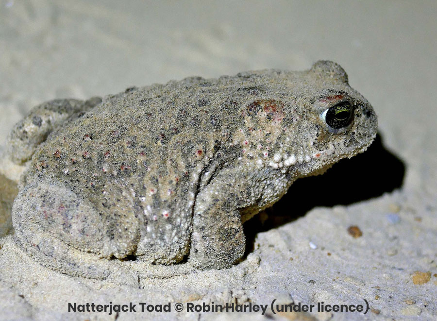
Natterjack Toads
We are also supporting the conservation of Natterjack Toads within Hengistbury Head Nature Reserve through the funding of a specialised pond.
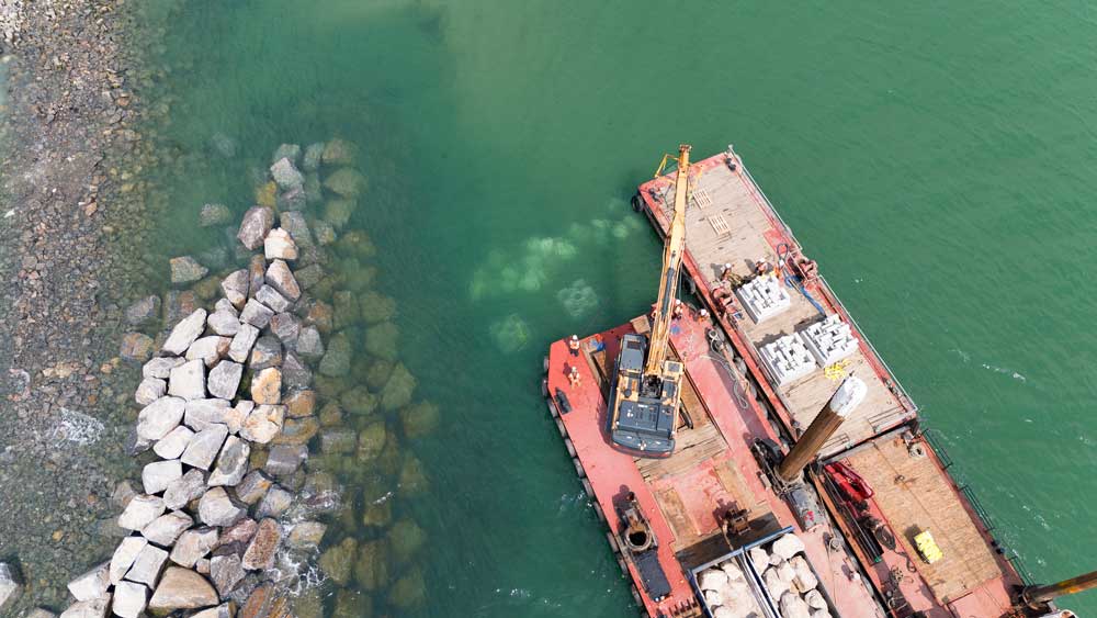
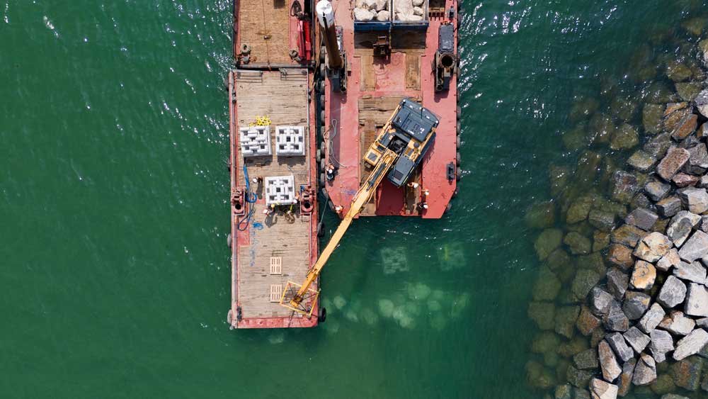
Installing the environmental enhancements
Placing rock protection for cubes
Reef Installation
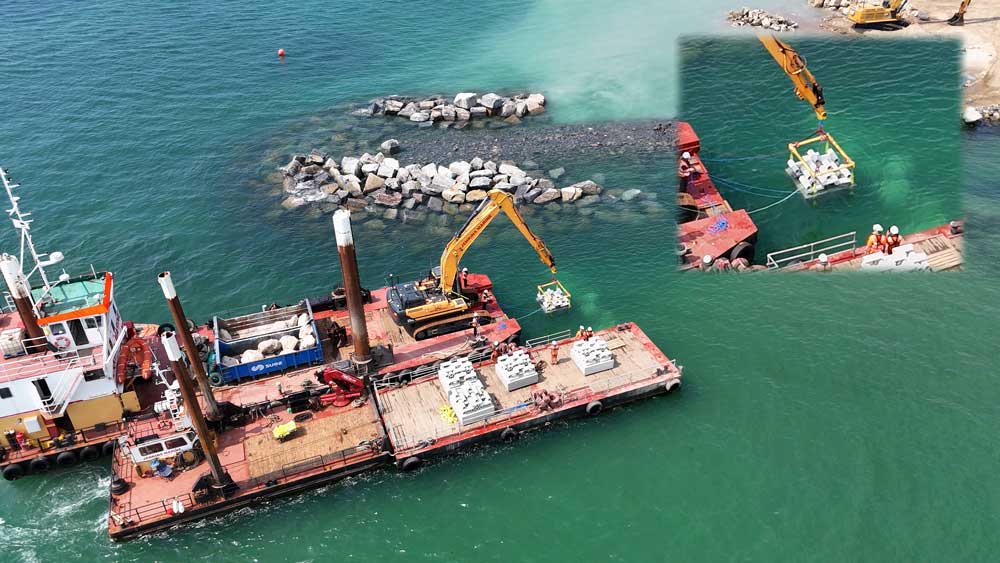
Cube placement
Cubes on barge
Cube lift
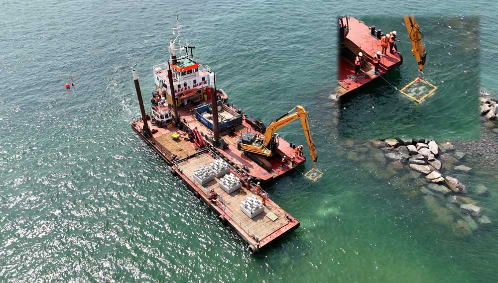
Cube placement
Cubes in-situ
Cubes in-situ
Cubes in-situ
Cubes in-situ

Drilling into old rock armour to create tide pools for the reef
A selection of tide pools awaiting installation
Project background
Several voids were discovered in the foundations of the structure during a detailed inspection in 2019, with an associated risk of localised collapse, so access was prohibited for safety reasons.
Ground Investigations, summer 2022
Underwater surveys mapped out the depth and land beneath the surface while borehole investigations revealed the composition of the ground below the structure. Boreholes up to 20m in depth were collected from both land and sea using a rotary drilling rig (on land) and a sea-based jack-up barge, as shown.
All data collected will help refine the most efficient and effective design for the new groyne structure to ensure the continued stability of the coastline, while protecting it from sea level rise over the next 100 years.
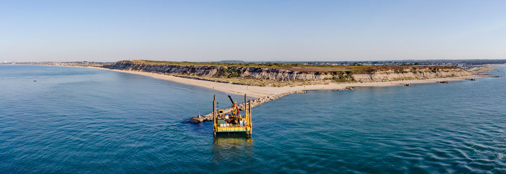
The Sandpiper jack-up barge worked on site during August, taking boreholes from five seabed locations immediately beside the long groyne.
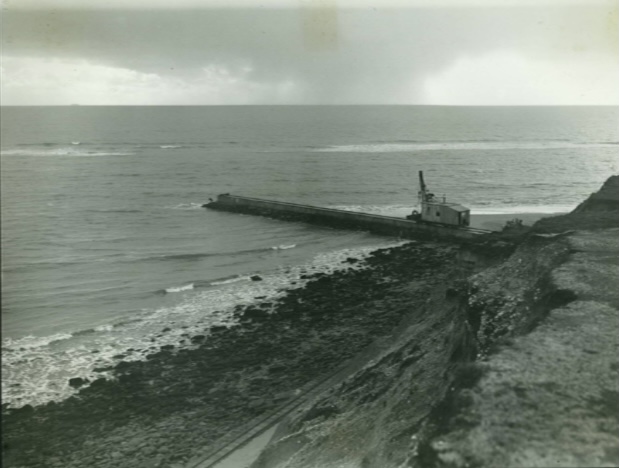
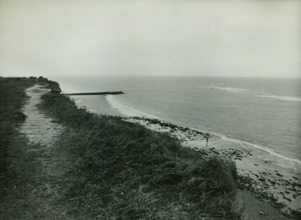
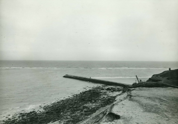
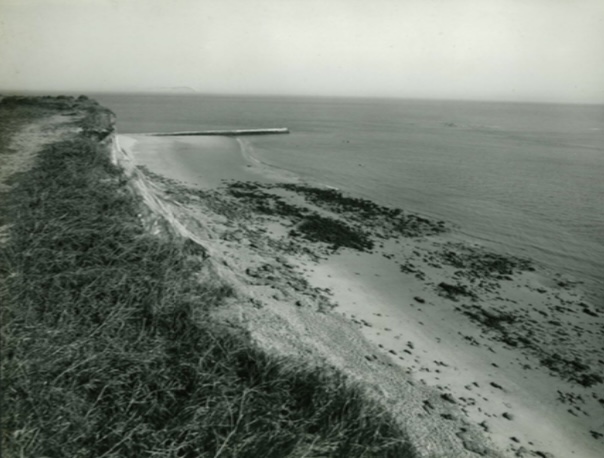
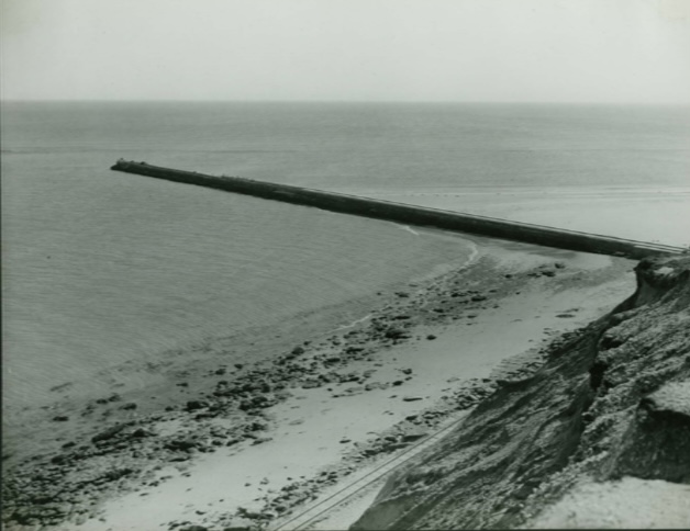
The purpose of the long groyne
The Hengistbury Head groyne was constructed between 1937–1939 to protect the headland. It is now well recognised as an “anchor point” that is critical to stabilising and controlling coastal erosion in both Poole Bay and Christchurch Bay. Along with the beach and other shoreline structures, the long groyne helps to protect local communities and infrastructure.
Without it, beach material would rapidly wash away (estimated with in a year), and the cliffs could start to erode again. This would eventually progress to the sea breaching into Christchurch Harbour via locations at Double Dykes and Mudeford Sandbank. The impacts could extend to the Purbecks and New Forest.
The current national policy for most of this populated coastal frontage is ‘hold the line’. This means that existing coastal defences should be maintained, upgraded or replaced in their current position, where funding permits, to reduce the risk of coastal flooding and erosion.
More about coastal defence policies at Poole & Christchurch Bays Shoreline Management Plan
The angle of the long groyne
In recent years, there have been proposals to alter the angle of the groyne, including potentially creating new surfing opportunities. The proposal has been reported on in the local media although it cannot be supported for important reasons, which are summarised as follows:
- It is crucial that the long groyne continues in its main function to limit long term coastal erosion in Poole Bay and Christchurch Bay.
- Coast protection is manageable under its existing configuration as set out in strategic policy (i.e. Poole & Christchurch Bays SMP) which is economically justified*.
- For the last 50+ years the long groyne has profoundly influenced the transit and deposition of beach material from Poole Bay into Christchurch Bay. The volume of beach material from Avon Beach and Highcliffe has then been managed by local beach recycling, when required – for example Christchurch Beach Recycling and Rock Groyne Repairs, spring 2021.
- A change in the angle of the groyne would generate new and unknown hydrodynamics that would affect the entrance to Christchurch Harbour.
- Modelling and data underlines layout changes as being high-risk with high uncertainty (in terms of being able to predict long term implications). Layout changes could trigger wide-reaching impacts on interlinked coastal protection assets across Dorset and into Hampshire.
- Hengistbury Head and its surrounding areas have many environmental designations (both national and international) which must be carefully adhered to. Additionally, the area falls into a Coastal Nature Park, as supported by other BCP Council strategies.
- The legacy council in Bournemouth invested in Boscombe as a surf-based tourism destination. It is supported by local facilities including year-round lifeguard cover, car-parking, toilets, showers, food outlets and accommodation. Hengistbury Head does not have the same offer and is in a more remote, potentially more dangerous location; exposed to swell waves and ebb currents from the Harbour.
* The Environment Agency is responsible for the approval and allocation of all coastal capital funding in England. Capital investment schemes go through an appraisal & approval process both on technical and financial grounds to secure grant funding. To be considered for funding schemes should be in line with the strategic direction set out in the SMP or strategy; they must also contribute to outcome measures and be on the sanctioned list.
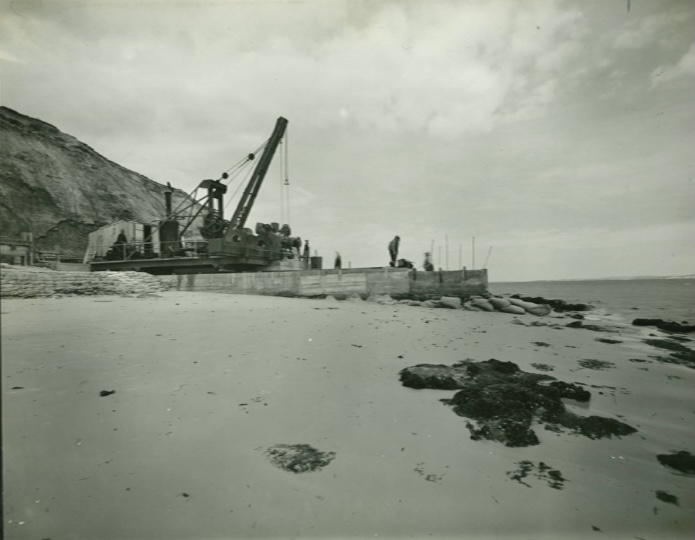
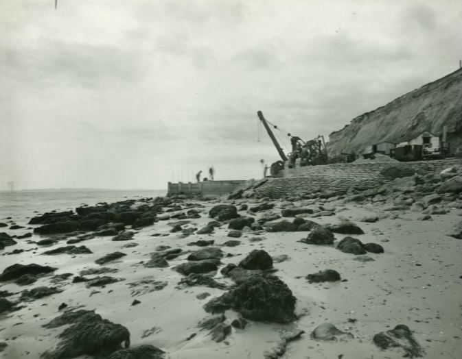
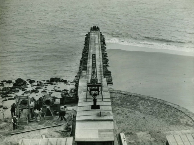
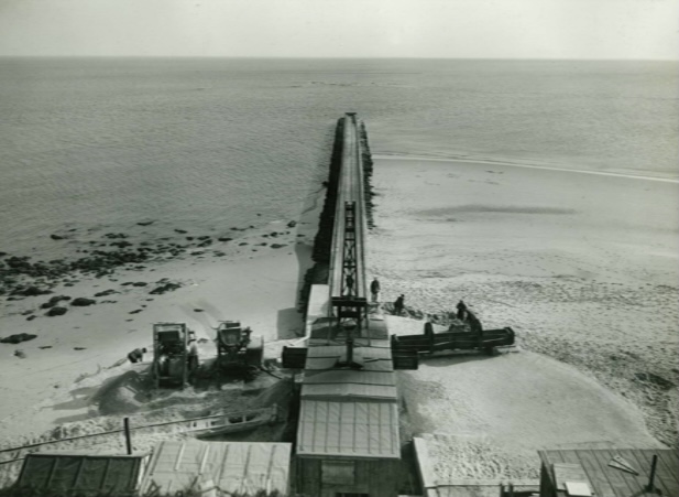
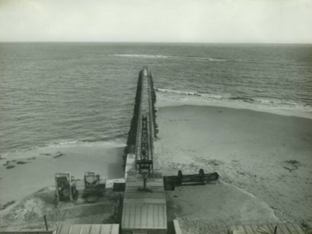
Constructing the long groyne 1937-39, photo gallery
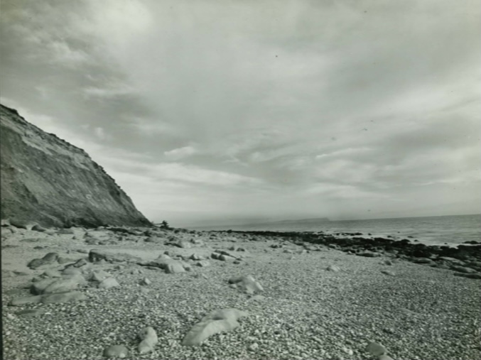
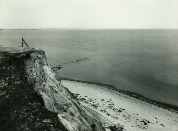
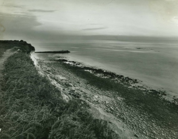
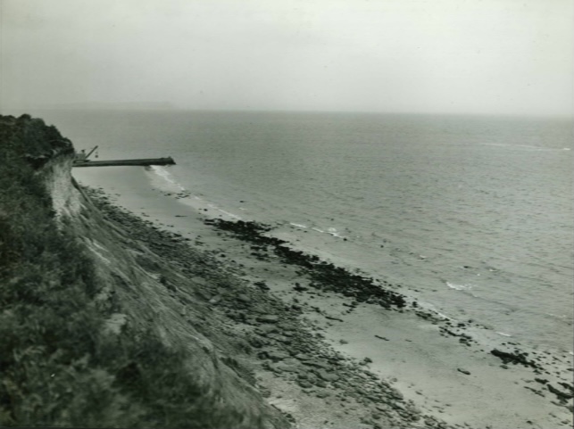
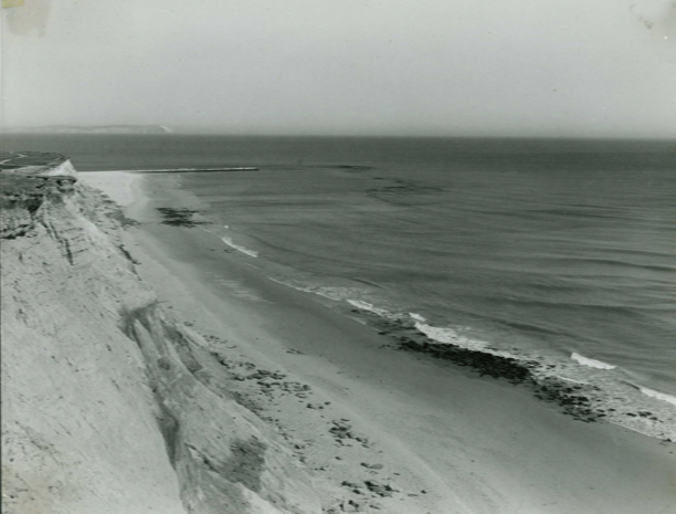
26th January 1937 26th January 1937 8th July 1937 8th July 1937 23rd August 1937 23rd August 1937 23rd August 1937 21st September 1937 21st September 1937 21st September 1937 20th October 1937 20th October 1937 19th November 1937 19th November 1937 16th March 1938 16th March 1938 14th April 1938 14th April 1938 15th May 1938 15th May 1938 2nd June 1938 13th August 1938 10th October 1938 10th October 1938 10th October 1938 10th October 1938 24th October 1938 1st June 1939 1st June 1939 1st June 1939 1st June 1939 1st June 1939 1st June 1939 1st June 1939 This photo was taken 19th November 1937, during construction of the long groyne; the southern-most tip of the headland shows the threat of erosion to the cliff face. Photo taken 1st June 1939; following its construction, beach material travelling from west to east along the shoreline quickly accumulated, providing some protection to the cliff. 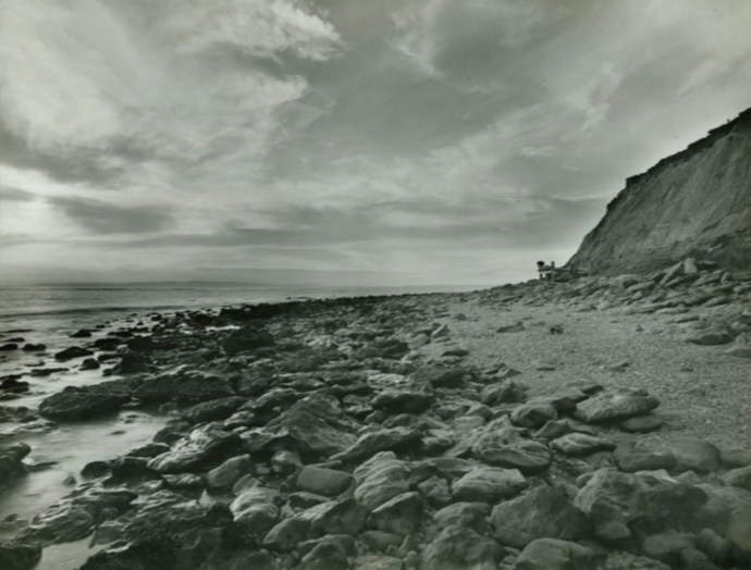
26th January 1937
26th January 1937
8th July 1937
8th July 1937
23rd August 1937
23rd August 1937
23rd August 1937
21st September 1937
21st September 1937
21st September 1937
20th October 1937
20th October 1937
19th November 1937
19th November 1937
16th March 1938
16th March 1938
14th April 1938
14th April 1938

15th May 1938
15th May 1938
2nd June 1938
13th August 1938
10th October 1938
10th October 1938
10th October 1938
10th October 1938
24th October 1938
1st June 1939
1st June 1939
1st June 1939
1st June 1939

1st June 1939
1st June 1939

1st June 1939

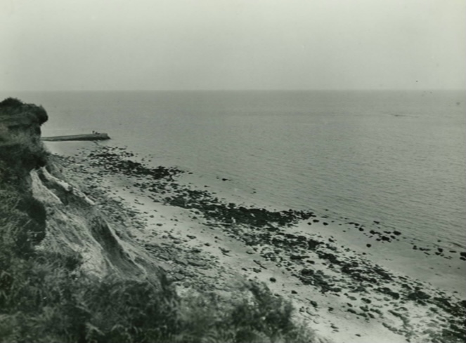
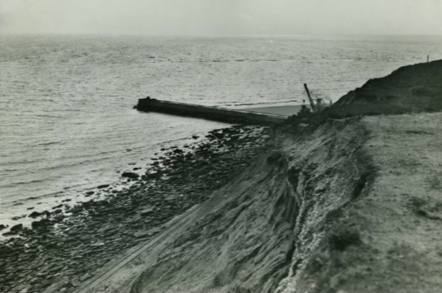
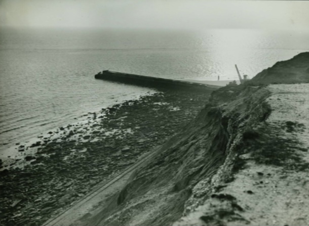
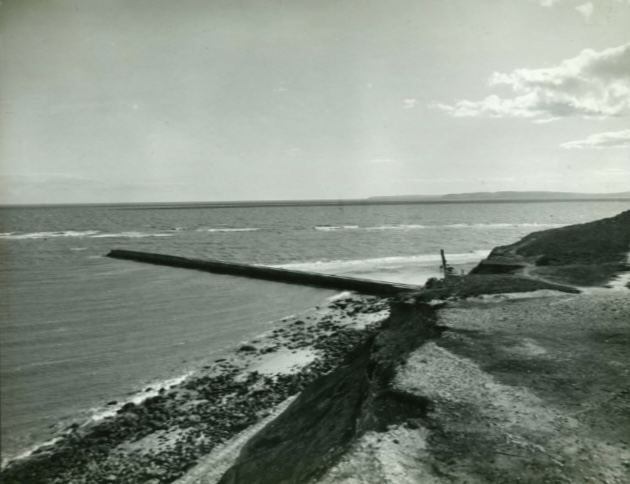
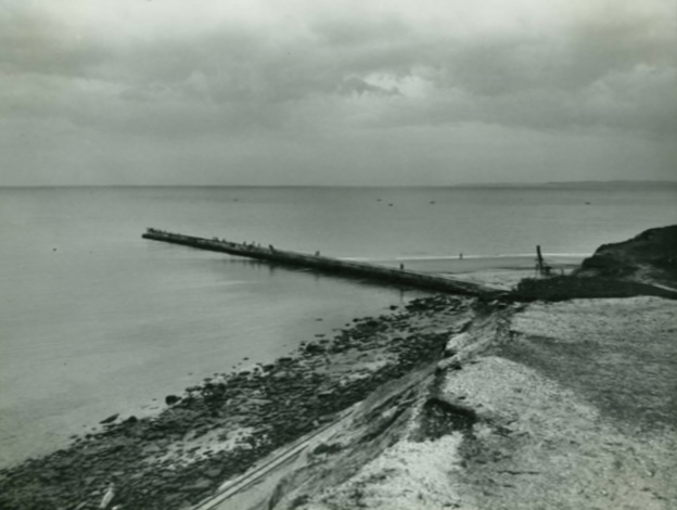
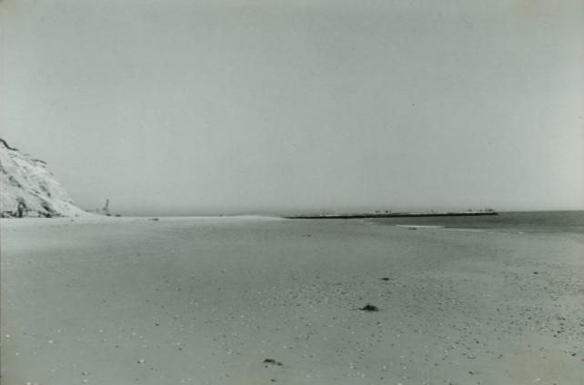
Hengistbury Head Long Groyne, November 1937
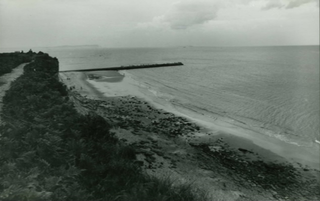
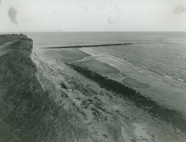
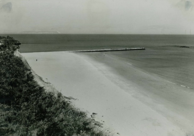
Hengistbury Head Long Groyne, June 1939
Construction of the original Hengistbury Head Long Groyne was completed in 1939. Its location has enabled beach material to accumulate around the headland, reducing erosion of the cliff face.
From the 1980s to the early 2000s rock armour was added to the concrete groyne structure, and additional groynes were constructed at Mudeford Sandbank, which have further helped stabilise the Sandbank in its current position.